Searching for Properties within Opportunity Zones
|
The following information will guide users through the process of using Opportunity Zones to help easily and quickly identify properties that can offer CDFI tax incentives to potential buyers and investors . The search capabilities found in app will give the user the ability to reference CDFI data to find the parcels within a Low-Income Community and / or Non-LIC Contiguous zone.
|
1. How to view the Opportunity Zone Layer
- Click the Layers Icon found on the main toolbar.

|
|
- Locate the Qualified Opportunity Zones Layer found within the Economic Development group in the Layers Panel.
Click on the checkbox to view the layer on the map.

|
2. The Opportunity Zone Information Panel
|
When clicking directly on an Opportunity Zone, this will open an information panel to get more in-depth information about that specific Opportunity Zone, as well as supplemental information regarding other related data layers and surrounding area.
|
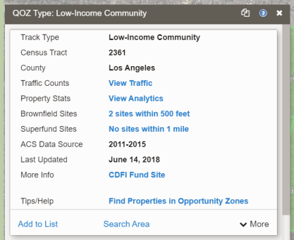
The Summary Card
Additional information available using the Command Links:
- Traffic Counts (View Traffic): Turns on the Traffic Count layer on the map.
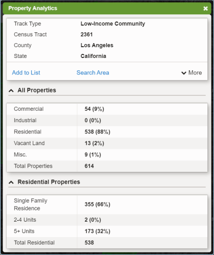
- Property Stats (View Analytics) Opens a window that displays property statistics of parcels withing that specific Opportunity Zone that can be used to conduct more precise analysis of the types of properties and occupants within.
*See second screenshot to the right
- Brownfield Sites: Indicates how many Brownfield Sites are within 500 feet of the specific Opportunity Zone. Clicking the command link will open the Brownfield Sites layer on the map.
- Superfund Sites: Indicates how many Superfund Sites are withing 1 mile of the specific Opportunity Zone. Clicking the command link will open the Superfund Sites layer on the map.
- CDFI Fund Site: Opens the U.S. Goverment website which explains in detail the purpose of Qualified Opportunity Zones.
- Find Properties in Opportunity Zones: Takes you this reference page you are viewing now.
|
*Property Analytics Window Example
|
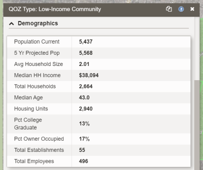
The Demographics Card
- This card displays the demographic information related to the specific Opportunity Zone which is gathered from the Demographics data layer.
|
|
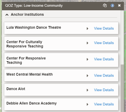
The Anchor Institutions Card
- Anchor Institutions are businesses (POIs) that have been determined to be sites that will have longevity in an Opportunity Zone and can have added value to investing in properties here due to the the business stability they offer in that Opporutnity Zone.
- Clicking the View Details command link for an Anchor Institution< will open its information panel from the Points of Interest data layer.
|
|
3. How to search for properties using Opportunity Zones
|
This process is as simple as conducting a Property Search as you normally would, but ensuring the option to look inside Qualified Opportunity Zones is selected, as shown in the steps below.
|
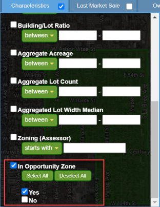
- Make sure the Property Search is currently the active search.
- Under the Characteristics filter, select the In Opportunity Zone by placing a check in the box to indicate it is ON.
- Select "YES" to search inside of any Opportunity Zone visibile on the map screen.
Note: If you want to search for properties NOT inside any Opportunity Zones, simply select "NO" instead.
|
|
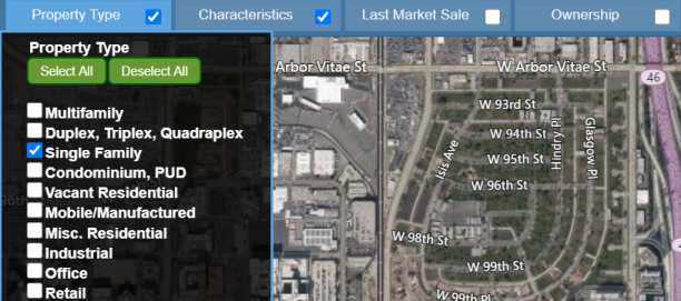
- At this point conduct a property search as normal by selecting the filters needed for your search.
Note: for this example, the filter Property Type: Single Family was selected.
- Click the Apply Filter button when done selecting filters.
|
|
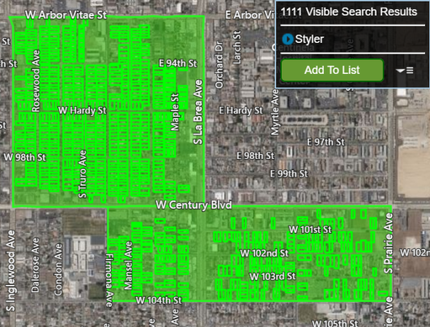
- The map will display all properties found based on your search that are located inside any Opportunity Zones visible on the map.
- The search results can now be added to a Results List by clicking the Add To List button.
|
|
Related Documents
|