|
LandVision™ Help > Documentation > School Data
|
|
There are two main types of school data available within LandVision: Basic Schools Data (for LandVision Builder), which provides school district boundaries with aggregate school ratings, and Premium Schools Data, which provides individual school attendance zones with corresponding ratings (available for most LandVision editions). |
Viewing School District Ratings
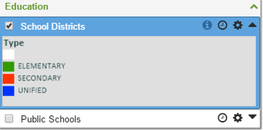
- Click on the School Districts layer in the Legend to turn it on. (The Blue Check
 means the layer is turned on.) means the layer is turned on.)
- School districts appear on the map, color-coded based on their Rating.
- The color-coded Rating is explained on the School Districts layer: 1 (worst) to 10 (best).
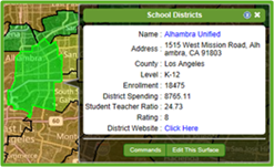
- Click your school district of interest on the map. The School Districts window appears with data about the district.
- Click the Name link to view ratings of individual schools within the district.
- Click the District Website link to view the district’s website.
|

|
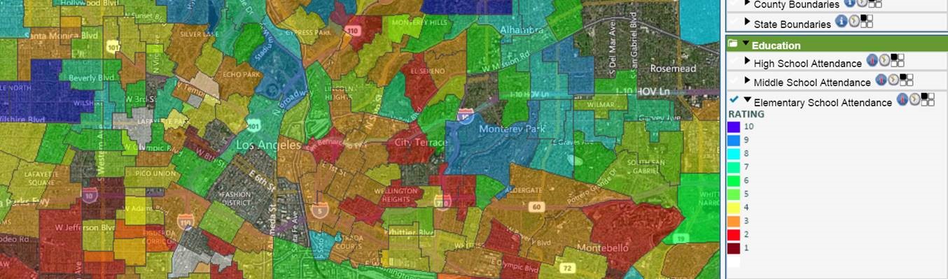
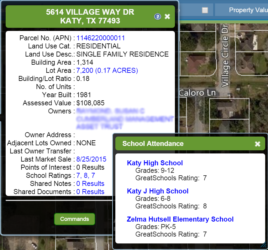
Premium School Data
LandVision provides many tools for analyzing land and property, including visual mapping and insights into local schools. We have now added school attendance zones and individual school quality ratings. The map display is color-coded by individual school rating, and at the parcel level, you can quickly see the assigned schools and are presented the rating.
|
Related Information
|