
|

|
|
INTEGRATION WITH VIRUTAL EARTH'S
|
|
OBLIQUE IMAGERY
|
|
|
|
|
INTEGRATION WITH VIRUTAL EARTH'S
|
|
OBLIQUE IMAGERY
|
|
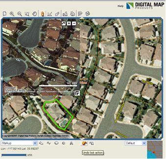
For properties identified in LandVision, you can also view Microsoft's Virtual Earth
Oblique imagery (only available in select areas) without the inconvenience of leaving
LandVision. |
|
|
View properties in higher resolution and from multiple vantage points (North, South,
East, West).
To use:
|
|
|
QUESTIONS?
|
If you have questions or problems using these new features, contact Digital Map's Customer Success Team at:
If you'd like to view this document in the future, click on the "What's New" link in the upper right hand corner of your LandVision screen.
 icon is showing in the upper left corner of the map. This indicates an oblique
view is available for your selected property
icon is showing in the upper left corner of the map. This indicates an oblique
view is available for your selected property icon
icon  and
and
 icons
icons