EASIER TO USE LANDVISION™ INTERFACE


LandVision™ Help >> What's New >> Version 8 >> Interface

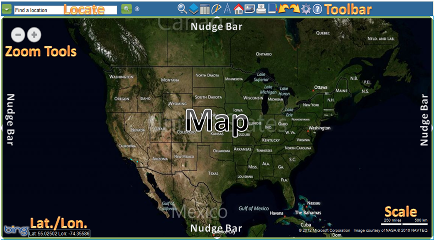
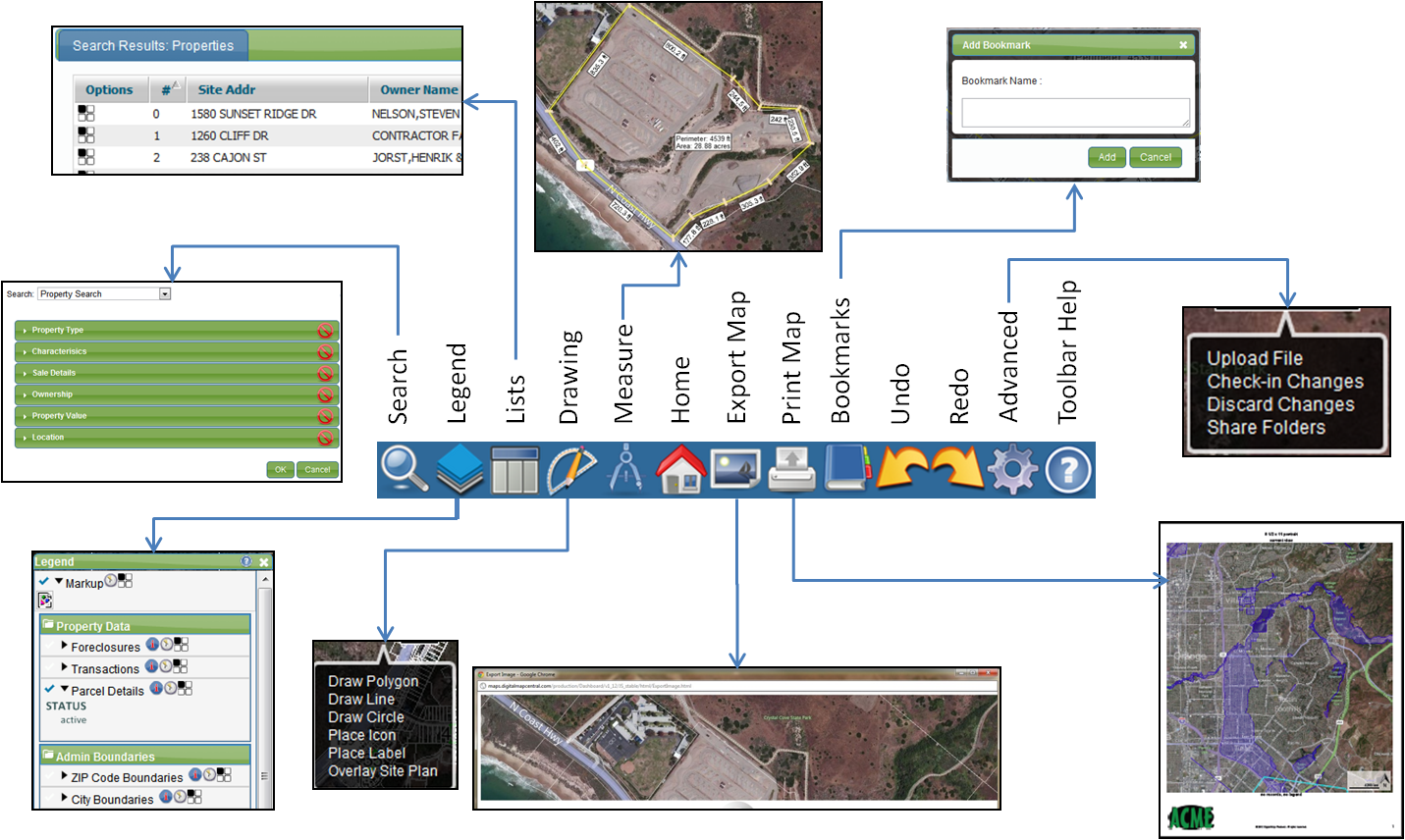
To say that LandVision™ Version 8 is all new would be an understatement, and nowhere is this more evident than with the user interface. We literally rethought the entire design of the previous version and produced a user experience that will feel completely new, yet very familiar at the same time. Here's how:

Farmiliar Features, New Layout

  • Navigating the map is easier than ever with Microsoft® Bing™ Maps platform
    • You no longer need to select tools to navigate the map and identify properties; simply use your mouse and some keyboard shortcuts to perform the full array of navigation and identify functions
    • Click and drag the map with your default mouse pointer to move the map
    • Use your mouse's scroll wheel or computer touchpad's scroll mechanism, double click, or use the zoom icons in the upper left corner of the map to zoom in and out
    • To zoom to a rectangle, use Bing Map's native technique of holding down the Shift key on your keyboard as you drag your mouse over your target area in the map

  • An easier to use toolbar at the top of the screen provides quick access to the most commonly used features in LandVision™
    • Icons are now more descriptive and increase in size as you hover over them
    • Each icon will launch another window, activate an interactive tool, or open an options menu
    • For an up close look at the new toolbar check out the image below

  • Retrieving layer information in LandVision™ is all new with an interactive information box displayed directly over the map
    • Gain quick insights about your identified property or feature to determine if you'd like to view detailed information
    • Use Commands to get more information about your subject feature, some of the standard commands for the Parcel layer include:
      • Copy Geometry lets you duplicate the shape of the subject feature in another layer (e.g. convert a parcel boundary into a Markup for custom visualization and editing)
      • Use the selected feature's geometry as a search area with Add as Inclusion and/or Add as Exclusion
      • Measure On gives you the selected feature's lot area and boundary measurements
      • Details - launches a new window with additional information about the subject feature
      • View Microsoft's Bird's Eye imagery
      • Build a list of properties using Add to List
      • See additional tax records of condos/multi-property parcels or additional features in the same location using Show Additional Records
      • Research the owner and seller with Owner/Seller Entity Lookup

Digital Map Products now offers on-demand online training videos. These complimentary videos are designed to give you an overview of the software and demonstrate how to use selected product features.

  • Click here to view the on-demand training videos

If you have questions or problems using any of the new features of LandVision™ 8, contact Digital Map Products' Customer Support Team at:

Return to Top


© Copyright 2018 Digital Map Products About DMP | Contact Us