|
GovClarity™ Help > Documentation > Panels & Cards
|
|
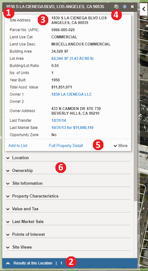
The Location Information Panel is the main window that opens up whenever you click on a parcel, or feature on the map in GovClarity™. The Cards are the individual sections of information on the Location Information Panel.
|
Location Information Panel & Summary Card
|
- Location Information Panel - When you click on a parcel the Location Information Panel opens. This panel houses the cards of information, the results at this location, the copy to compare feature, the commands (blue links), and the feature panel.
- Results at this Location & More Results - Allows you to see the number of results at the location. If you click More Results, it will pull up the results for other features/layers in the immediate vicinity.
- Summary Card - The summary card is a short list of key information for the feature selected in the layer.
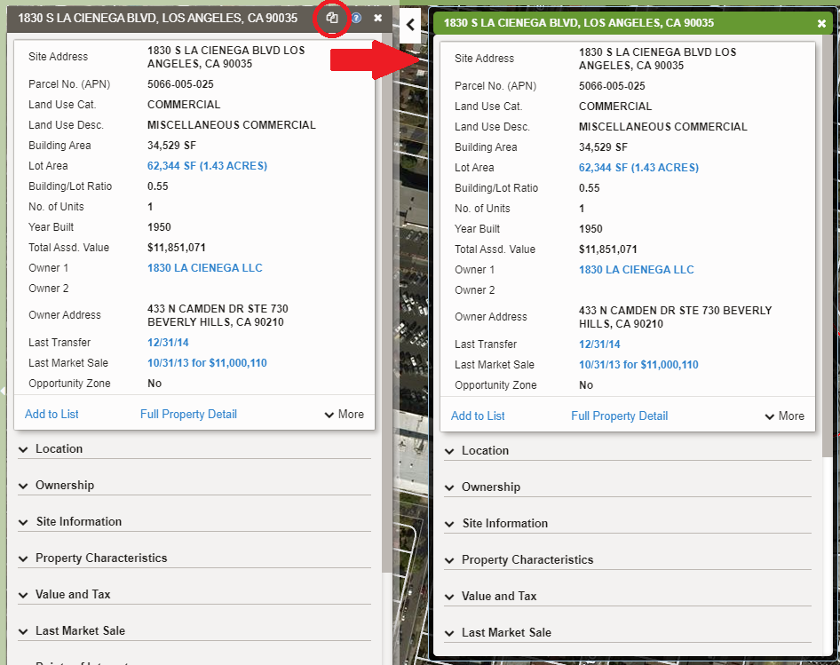
- Copy to Compare - Clicking the Copy to Compare
 icon allows you to open the Comparison Panel, with a copy of the information from the Location Panel. The Comparison Panel, is convenient when you need to compare two different properties, or two different features from two different layers (e.g. Demographics vs. Parcel Data). The Comparison Panel is static, so the information will not change as you select other features. icon allows you to open the Comparison Panel, with a copy of the information from the Location Panel. The Comparison Panel, is convenient when you need to compare two different properties, or two different features from two different layers (e.g. Demographics vs. Parcel Data). The Comparison Panel is static, so the information will not change as you select other features.
- Commands - The Commands are the blue links found on the cards within the Location Panel. They enable you to take further actions once they open the location panel for a specific property; giving a wide range of capabilities: from pulling up the transaction history, running a site profile report, creating a map exhibit with retailer logos, to opening an owner portfolio. Learn more about each command here.
- Expanded Card - There are additional cards containing more property information available. Each card can be expanded or collapsed by selecting the title of the card.
|
Clicking the Copy to Compare icon on the Location Information Panel allows you to open a new window, the Comparison Panel, that is a copy of the information from the Location Panel.
|
|
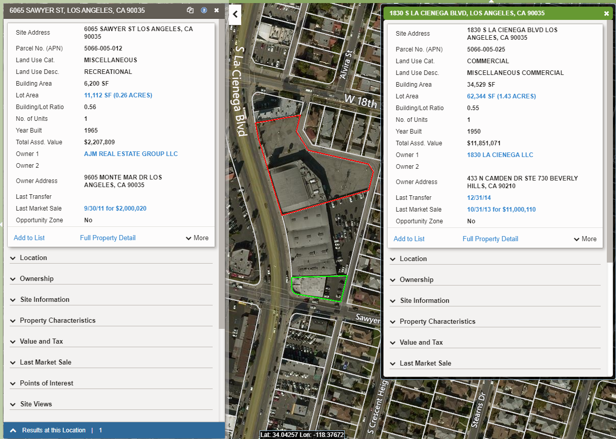
With the information copied to the Comparison Panel, you can 'X' out of the Location Information Panel to pull up a different property to compare. Alternatively, you can use the Location Information Panel to look at data from a different layer. In the example below, we are comparing the Demographics data, to the Location Information.
|
The information in the Comparison Panel is static, and the window will remain open until closed by clicking the 'X' in the top right corner of the panel.
On the map you will see the both properties higlighted on the map. The feature (or property) higlighted in red will have it's corresponding data in the comparison panel. The property highlighted in green will have the data displayed in the Location Information Panel.
|
|
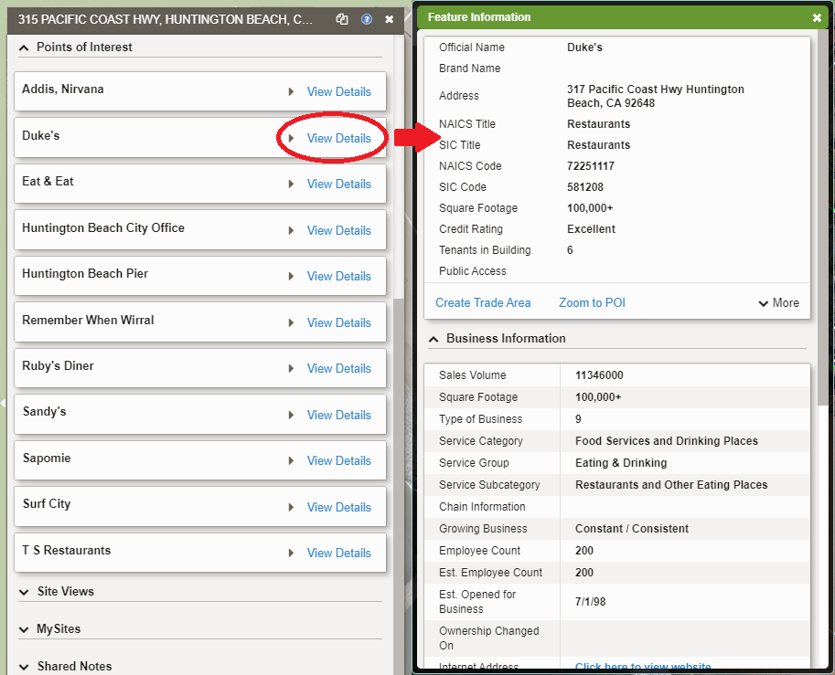
Using The Feature Information Panel
The Feature Information Panel is a way to view more details about a feature. In the example below, the Points of Interest card on the Location panel lists the Points Of Interest in the area. To view more information about a specific Point of Interest, we can click View Details. This opens the Feature Information Panel for the corresponding Point of Interest.
|
|
Related Documents
|