HAZARDS DATA


LandVision™ Help > Documentation > Hazards

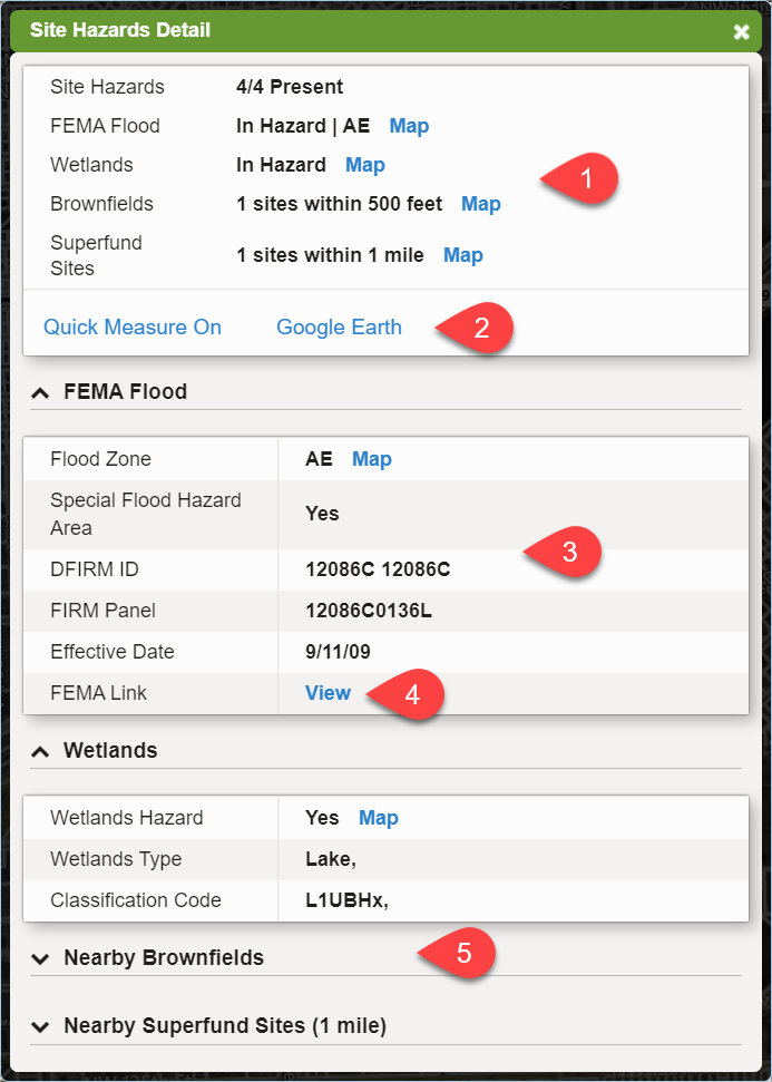
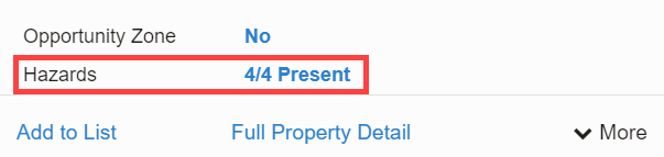
When viewing a Location Information Panel for a parcel, one of the available command links is for Hazards. The text of the command link itself will list how many out of the four hazard types applies to the parcel.

Hazard Command Link

To view more detailed information about the applicable hazards, click on the command link to open the Hazards Information Panel.

Hazard Information Panel


Hazards Info Panel

  1. Hazard Layers Summary - A list of all available hazard layers in LandVision and whether or not the hazard type applies to the parcel. Clicking on the "Map" command link will open the layer on the map.

  2. Additional Tools - Command links to additional analysis tools are available to aid in parcel research.
    • Quick Measure - Turns on/off the lot area measurement labels.
    • Google Earth - Downloads a .kml file to be able to view the parcel in the Google Earth app.

  3. FEMA Flood Data - This card contains all of the FEMA flood zones specific data. Providing both the Digital Flood Insurance Rate Map (DFIRM) ID number and Flood Insurance Rate Map (FIRM) Panel number.

  4. FEMA Link - A link directly to the FEMA Flood Map Services Center is provided for further, more detailed research.

  5. Expanded Card - For additional hazard data, if these apply to the parcel, their sections can be viewed to see the information specific to that hazard. Each card can be expanded or collapsed by selecting the title of the card.
    • Wetlands
    • Nearby Brownfields
    • Nearby Superfund Sites

Related Documents


© Copyright 2021 Digital Map Products About DMP | Contact Us