GOVCLARITY SPRING 2016 RELEASE
|
GovClarity® Help > What's New > GovClarity Spring 2016 Release
|
|
Digital Map Products is excited to announce the Spring 2016 release of GovClarity. This latest version includes robust user interface improvements, significant data enhancements as well as new features and is the result of your valuable user feedback.
Keep reading below for more details on what's new in the GovClarity Spring 2016 release and for links to additional information how to use these new features.
|
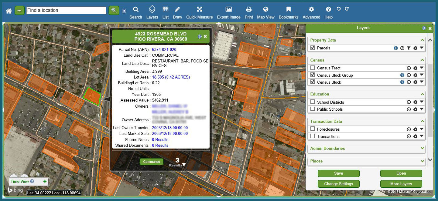
User Interface Improvements
|
|
GovClarity has a new look and enhanced usability! GovClarity is now even easier to use as we've made substantial improvements to the product interface with a research-based approach incorporating our customers' input. We've revamped the main Toolbar, Layers (formerly Legend) Display, Search Filter options, and other areas. The updated interface boasts a sleek, modern look and feel.
In this GovClarity Spring 2016 release, you can more clearly see menu options available to you, understand how they work, as well as discover new features more easily. You will be able to locate information, access parcel and property details, navigate the map screen, and perform regular tasks even more rapidly now with improved menu iconography and more intuitive work flows.
|
|
|
Visit the links below to learn more about using key areas of the GovClarity interface:
Product Interface |
Toolbar |
Search Filters |
Layers
|
Sales Transactions Data Updates
|
|
GovClarity includes detailed national parcel and property data coverage, including recent sales transaction information. In this release, we've greatly expanded our sales transaction data across the country, bringing the total number of counties providing continuous sales transaction updates to over 2000. Working with a Fortune 500 partner, we process the latest sales transaction data as soon as it is available, thus enabling our clients to consistently access the most current information in GovClarity.
|
Pictometry Interface Integration
|
|
For GovClarity clients that also subscribe to Pictometry, now you can access Pictometry directly via GovClarity and move between the two applications for heightened location intelligence. The Pictometry integration to their web service enables GovClarity users to select a location on the GovClarity map screen and launch the Pictometry application within an iframe web browser for further map analysis.
|
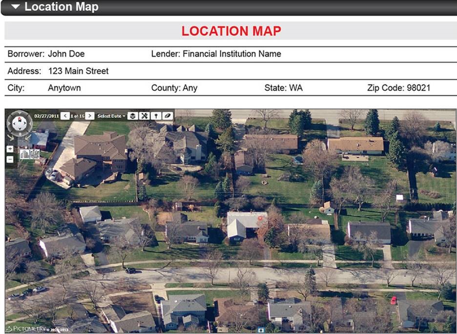
*The Pictometry integration feature is available for GovClarity clients that also have a Pictometry Gateway API subscription. If you already subscribe to the Pictometry Gateway API, contact your Digital Map Products Account Manager or Customer Support Manager to incorporate the Pictometry Interface into your GovClarity account.
|
Performance Improvements
|
|
The Spring 2016 release is full of performance improvements that make GovClarity even faster, more stable and reliable. We've been busy upgrading our underlying technology platform with cutting-edge database architectures as well as hardware improvements, which facilitates more powerful and interactive search and filter capabilities at more rapid speed. We're always striving to improve performance of our products, including during times of peak usage, so our customers can consistently take advantage of faster speed to decision and larger, more complex data analysis than ever before.
|
|