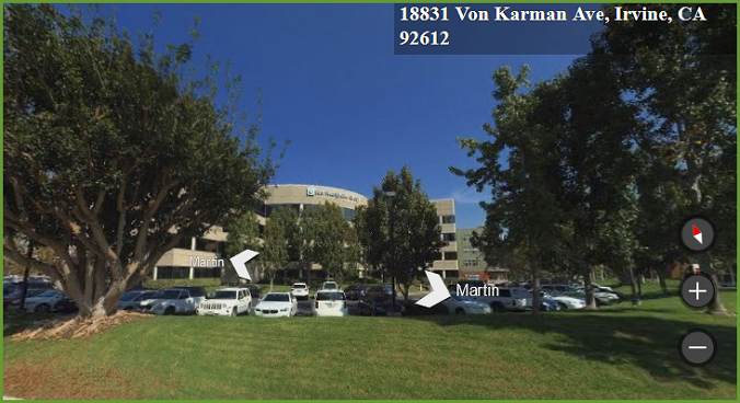
Use Streetside view to see a ground level view of a property and surrounding area, without having to leave your office! Streetside view imagery can be viewed by right clicking on the map and choosing the Streetside option.
Using Streetside View
From any point on the Map:
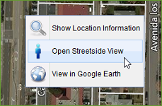
Right click on the street where you would like to see the Streetside View imagery.
Choose the Streetside View option from the right click menu
A new window opens with Street View where you can pan, rotate, and view other areas from the street.