|

|
LANDVISION 8.11 RELEASE
| LandVision Help > What's New > 8.11 Release | ||||||
|
Welcome to the 8.11 release of LandVision. For this release, we've focused on improving your efficiency and workflows, and are pleased to introduce the following:
Keep reading below for more details on what's new in the latest release of LandVision and for links to additional information on how to use these new features. |
||||||
|
||||||
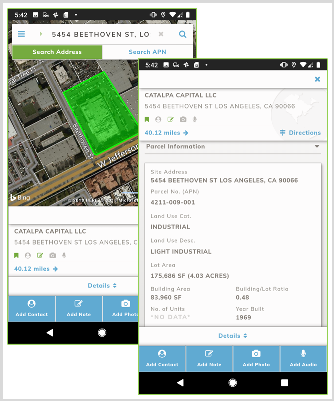
New Mobile ApplicationLandVision for mobile delivers a new and improved experience while on the go. Check out the properties around you, navigate the map, add your own content to the properties, understand natural hazards on a parcel, or check out nearby major retail locations with the new app! Now available for LandVision Commercial Real Estate Edition and Builder Developer Edition
Visit the links below to learn more about this feature: |

|
New Data to Find the Best Opportunities
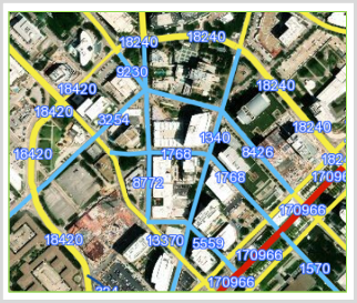
Updated National Traffic DataNow included with your LandVision Commercial and Builder subscription, the Department of Transportation’s traffic data is now available as a nationwide data set. Look for the “DoT Traffic” layer in your layers panel to get an idea of the traffic volume nearby the properties that you’re looking at.
Visit the link below to learn more about this feature: |

|
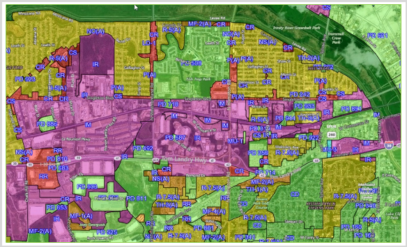
Zoning DataIn partnership with Zonability, standardized zoning information is now available to you as an add-on for LandVision. Give your account administrator a call to see about subscribing to this data set today!
Visit the link below to learn more about this feature: |
|

Note: Zoning data is only available in select markets, but those markets will be increased over time. |
|
General Usability Enhancements
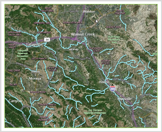
Enhanced Integrated Esri Feature LayersGetting data from local government sources, or even setting up a connection to your own server just got even easier. Give our Integrated Esri Feature Layers add-on a spin and check out the new easy to use interface. Pictured: California Water Rights |

|
More Flexibility when SearchingSearching for properties underneath something like zoning has always been a bit tricky. Now, with this new feature, you can choose to eliminate some false positives in your search by buffering inward.
Visit the link below to learn more about this feature: | |
Improved SecurityYour data being secure is always a concern and we’ve made several enhancements to improve that security! Most noticeably, HTTPs is now a standard encryption for your information. | |
|
Return to Top |
| © Copyright 2018 Digital Map Products | About DMP | Contact Us |