LANDVISION 8.13 RELEASE
|
LandVision
Help >
What's New > 8.13 Release
|
|
Welcome to the 8.13 release of LandVision. For this release, we've focused on improving your efficiency and workflows, and are pleased to introduce the following:
- LandVision Mobile now for all editions
- Updated Data
- General Usability Enhancements
Keep reading below for more details on what's new in the latest release of LandVision and for links to additional information on how to use these new features.
|
Experience LandVision On the Go
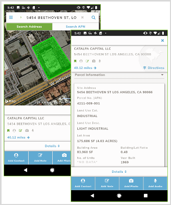
LandVision Mobile
Everybody’s favorite, the LandVision Mobile app, is now available for all LandVision editions (welcome to LandVision on the go, LandVision Enterprise users).
Stay connected with your information in LandVision while on the go with our new mobile app. Check out the properties around you, navigate the map, add your own photos, contacts and notes to properties, understand natural hazards on a parcel, or check out nearby major retail locations. You can even view your own data and map layers in LandVision mobile.


Visit the links below to learn more about this feature:
LandVision Mobile | Field Sites | My Sites
|
|
|
New Data to Find the Best Opportunities
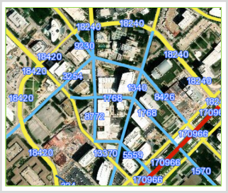
2017 Traffic Data
Our Traffic Data from the Department of Transportation has been updated (2017). View valuable details on road segments such as the speed limit, median type and presence, and road type. You can even find properties on road segments with your desired traffic with our multi-layer search capability. Plus, the 2016 data is still available for comparison.
Traffic Counts are included with all Commercial and Builder editions, and an add-on for LandVision Enterprise. Contact us today to find out more!
Visit the link below to learn more about this feature:
Traffic Data
|
|
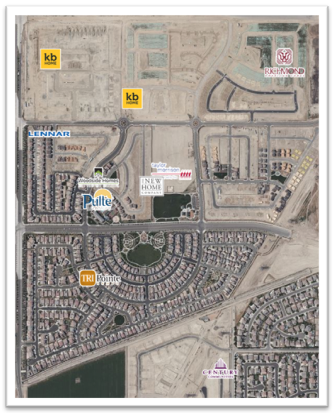
Builder Sites Data*
Builder Sites are now represented with the builder’s corporate logo, instead of a house icon. This should speed your visual analysis of new development sites.
And if you’re ever looking for a simplified view, you can always access the original house icons through the Edit Style command on the layer in the Layers Panel, or even create your own unique style for the Builder Sites layer.
*For LandVision Builder Developer Edition Only
|
|
|
General Usability Enhancements
More Flexibility when Searching
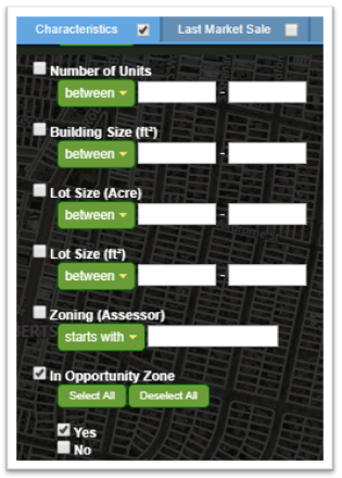
Qualified Opportunity Zones*
Finding properties in tax-advantaged Opportunity Zones just got a whole lot easier. Now there’s an Opportunity Zone search field on the Property Search form. Simply select “Yes” and enter your target property criteria.
*For LandVision Commercial Real Estate and Builder Developer Editions Only
Visit the link below to learn more about this feature:
Qualified Opportunity Zones
|
|
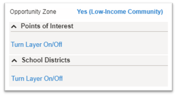
Turn Map Layers on from the Info Panel
To save you time, we’ve added shortcuts on the Information Panel to turn map layers on and off.
Look for blue links on field values (mouse over text indicates whether there is a map layer) or the command “Turn Layer On/Off.”
Clicking once will activate the layer on the map and clicking again, will deactivate the layer on the map.
Currently map shortcuts are available for: Opportunity Zones, Points of Interest, School Districts, Flood Zones(DFIRM) and Wetlands.
|
|
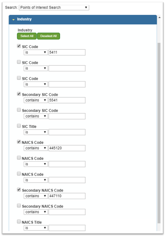
Points Of Interest*
The Industry filter under the Points of Interest Search now includes multiple and secondary SIC / NAICS codes to broaden the search capability since some businesses have more than one code based on their type of business.
*For LandVision Commercial Real Estate and Builder Developer Editions Only
Visit the link below to learn more about this feature:
POI Search Filters
|
|
Security Improvements
Your data being secure is always a concern and we’ve enhanced our browser security with upgraded authentication support.
|
|
|